
Random Country Generator 🌎
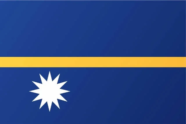
Nauru
🏙️ Capital city:
No official capital; government office located in Yaren District
📈 Country population:
12,000
🗺️ Country area:
21 km²
Core Facts / Infobox
Present this as a clean two-column table containing accurate and verified national facts. Include only fields with real data.
| Official Name | Republic of Nauru |
| Common Name | Nauru |
| ISO Codes | NR, NRU, 520 |
| Internet TLD | .nr |
| Calling Code | +674 |
| Capital City | No official capital; government offices located in Yaren District |
| Largest City | Denigomodu |
| Coordinates | 0.5° S, 166.9° E |
| Time Zone | UTC+12 |
| Population (2025 est.) | ~12,000 |
| Area | 21 km² |
| Population Density | ~570 per km² |
| Languages | Nauruan, English |
| Currency | Australian Dollar (AUD) |
| Driving Side | Left |
| GDP (Nominal) | ~USD 130 million |
| GDP Per Capita | ~USD 11,000 |
| HDI | 0.603 (Medium) |
| Literacy Rate | ~96% |
| Life Expectancy | ~60 years |
| Continent & Subregion | Oceania — Micronesia |
| National Day | 31 January (Independence Day) |
| National Sport | Australian Rules Football (AFL) |
| National Dish | Coconut Fish |
| National Anthem | Nauru Bwiema |
Geography & Environment
- Nauru is a tiny island nation located in the central Pacific Ocean, northeast of Australia.
- The island is a single raised coral atoll with a central phosphate plateau.
- It has no rivers; freshwater relies on rainfall collection and desalination.
- Climate: tropical with consistent warm temperatures and seasonal rainfall.
- Best time to visit: April–October (drier and cooler).
- Nauru’s environment includes coastal beaches, coral reefs, and a rocky inland plateau.
- Environmental challenges: phosphate depletion, limited freshwater, coastal erosion, climate change.
Demographics
- Total population: ~12,000.
- Median age: ~26 years.
- Ethnic groups: Nauruan (~90%), other Pacific Islanders, Chinese, Australians.
- Religions: Christianity (Protestant & Roman Catholic).
- Literacy rate: ~96%.
- Main districts: Yaren, Denigomodu, Aiwo, Buada.
History
- Originally settled by Micronesian and Polynesian peoples over 3,000 years ago.
- German protectorate in the late 19th century.
- After WWI, administered by Australia, New Zealand, and the UK.
- Phosphate mining became the country’s main economic driver.
- Japan occupied Nauru during WWII.
- Gained full independence on 31 January 1968.
- Was briefly one of the world’s richest nations (1970s–1980s) due to phosphate wealth, later declined.
Government & Politics
- Government type: Unitary parliamentary republic.
- President serves as both head of state and government.
- Unicameral Parliament with 19 members.
- No official capital; Yaren District houses government offices.
- Key political issues: economic diversification, climate adaptation, migration agreements.
Economy
- Historically dependent on phosphate mining; reserves mostly depleted.
- Current economy relies on fishing licenses, foreign aid, and government services.
- Major industries: phosphate reprocessing, fishing, services, offshore banking.
- Main exports: phosphate, fish.
- Main imports: food, fuel, manufactured goods, machinery.
- Strengths: large Exclusive Economic Zone (fishing rights), regional partnerships.
- Weaknesses: limited resources, isolation, small population, climate threats.
- GDP sectors: Services (~70%), Industry (~20%), Agriculture (~10%).
Culture & Society
- Nauruan culture blends Micronesian traditions with Western influences.
- Strong family ties and community values define social life.
- Popular cultural expressions include traditional dance (rebot), crafts, and storytelling.
- Languages: Nauruan (native) and English (official for government and business).
- Major festivals: Independence Day, Angam Day (celebration of population recovery).
Food & Cuisine
- National food highlights include Coconut Fish and seafood dishes.
- Staple ingredients: coconut, breadfruit, taro, pandanus, fish.
- Popular foods: fried fish, tuna dishes, coconut-infused meals.
- Beverages: coconut water, imported soft drinks, tropical juices.
Education & Institutions
- Medium of instruction: English and Nauruan.
- Literacy rate: ~96%.
- Main institutions: Nauru Secondary School, Nauru Campus of the University of the South Pacific.
- Key study areas: education, marine studies, public administration.
Tourism
- Top attractions: Anibare Bay, Command Ridge, Buada Lagoon, WWII relics.
- Natural attractions: coral reefs, ocean cliffs, tropical fish species.
- Adventure tourism: snorkeling, fishing, cycling around the island (1-day route).
- Cultural tourism: historic phosphate mines, Nauruan traditions and festivals.
- Visa: most visitors require advance visa approval; some exceptions for Pacific nations.
- Transport: one international airport; limited local transport.
Practical Information
- Safety: peaceful, low crime.
- Healthcare: main hospital in Yaren; limited specialized care.
- Emergency numbers: Police 110; Fire 111; Ambulance 118.
- Plug type: I; Voltage: 240V.
- Internet: improving but relatively slow and expensive.
- Best time to visit: April–October.
- Budget: moderate; limited accommodation and restaurants.
Sports, Entertainment & Notable People
- National sport: Australian Rules Football.
- Popular sports: weightlifting, football (soccer), athletics.
- Notable athletes: Marc and Ovini Uera (weightlifting), Jonah Harris (Olympian).
- Entertainment: cultural dances, community gatherings, music festivals.
Neighboring Countries of Nauru
Nauru does not share any land borders. Its maritime neighbours include Kiribati, Marshall Islands, Tuvalu, Solomon Islands, and Papua New Guinea.
Famous For
- Phosphate mining history.
- Being one of the world’s smallest countries.
- Angam Day (unique population milestone celebration).
- Tropical ocean scenery.
- Micronesian cultural heritage.
- Ring road encircling the entire island.
Sources
- World Bank
- United Nations (UN Data)
- IMF
- CIA World Factbook
- Nauru Bureau of Statistics
- Government of Nauru